Getting Around Phoenix Without a Car
Greater Phoenix covers a large area, but public transit has expanded to connect major employment, education, entertainment, and residential districts. Riders can combine rail, bus, circulators, and regional routes. Service frequency and walking conditions vary, so the best trip is usually the one planned around both the timetable and Phoenix’s climate.
1. Valley Metro Rail
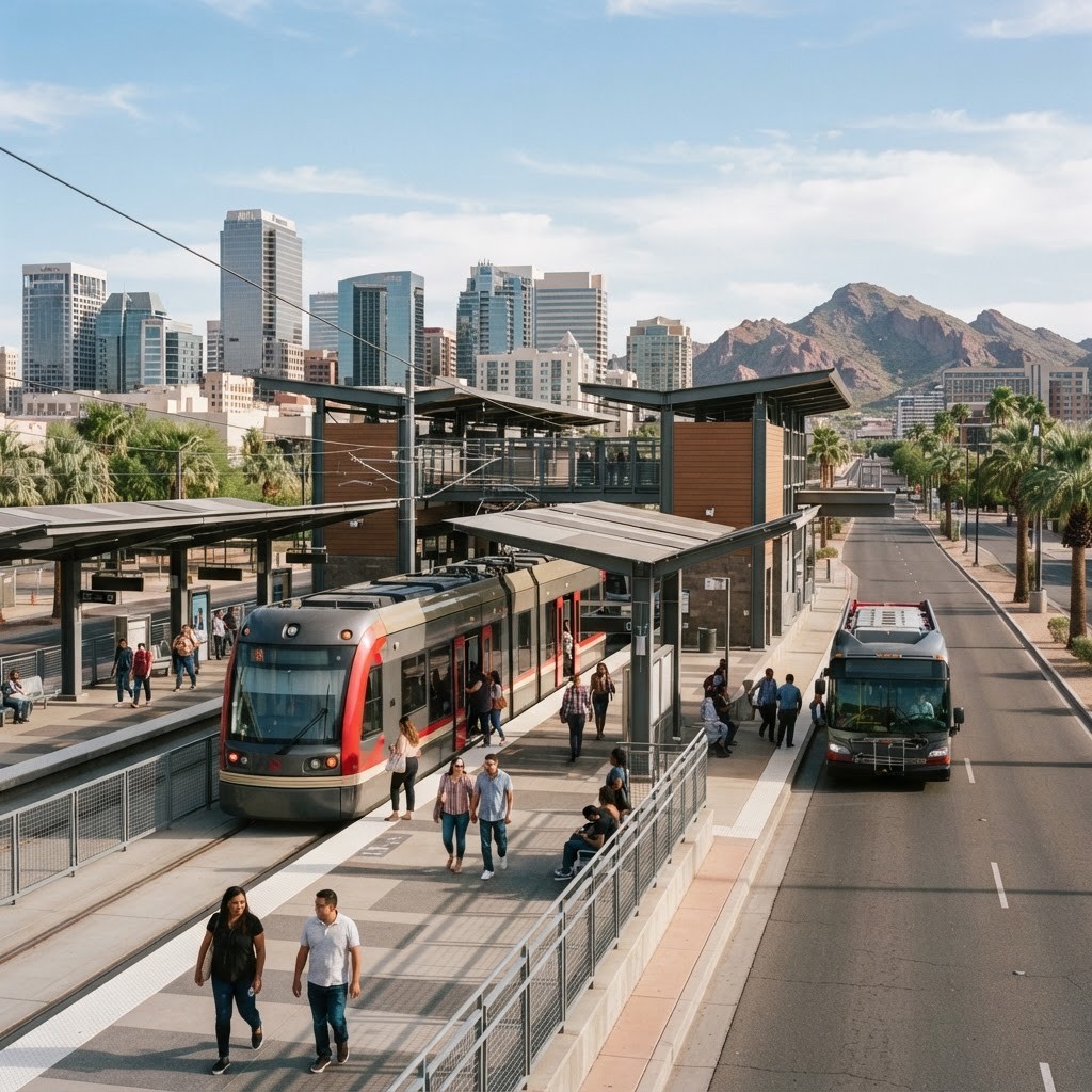
Valley Metro Rail forms the backbone of high-capacity transit in the region. It connects central Phoenix with Tempe and Mesa and serves destinations including downtown districts, cultural attractions, campuses, and Sky Harbor connections. Trains avoid freeway congestion and are especially convenient for major events when parking is limited.
2. Valley Metro Local Bus
The local bus network reaches far beyond the rail corridor. Routes operate along many major arterial streets and connect neighborhoods to schools, workplaces, shopping, and transfer centers. Frequency differs by route and time, so riders benefit from checking schedules and allowing extra time for transfers.
3. RAPID Commuter Bus
RAPID service is designed for peak-period commuting into central Phoenix from park-and-ride locations. Limited stops and freeway segments can make it more direct than a typical local route. It is most useful for workers with schedules aligned to weekday commute windows.
4. Express Bus Service
Regional express routes connect outlying communities and employment centers with fewer stops than local buses. These services can reduce the burden of long-distance commuting and provide an alternative to driving during busy periods. Riders should verify operating days, direction, and peak-only schedules.
5. Phoenix Dial-a-Ride
Phoenix Dial-a-Ride provides eligible riders with demand-responsive transportation under paratransit guidelines. It supports people whose disabilities prevent them from using fixed-route transit for some or all trips. Eligibility, reservations, pickup windows, and service boundaries follow specific requirements, making advance planning important.
6. Phoenix Neighborhood Circulators
Phoenix operates neighborhood circulator routes that connect local destinations and larger transit lines. These smaller-scale services can bridge the first or last mile between homes, shopping areas, community facilities, and major bus corridors. They are valuable where a full local route would be less practical.
7. Tempe Orbit
Tempe Orbit circulators provide fare-free neighborhood connections using routes named for planets. They serve residential areas, downtown Tempe, and connections to other transit. For students, residents, and visitors, Orbit can make short local trips easier while feeding into light rail and bus networks.
8. Tempe Streetcar
Tempe Streetcar connects key destinations around downtown Tempe and nearby districts. It complements light rail by circulating through areas with concentrated dining, education, housing, and entertainment. The streetcar is particularly useful for short urban trips that might otherwise involve a long walk in hot weather.
9. Scottsdale Trolley
Scottsdale’s trolley routes provide local circulation and links to regional transit. They can help riders reach civic, shopping, residential, and visitor-oriented areas without moving a car between stops. Route details and schedules should be checked because local services can change with operating needs.
10. Groome Transportation
Groome Transportation provides scheduled shared rides between Phoenix Sky Harbor and several Arizona communities. Although it is not an urban transit agency, it is an important regional mobility option for travelers connecting Phoenix with places not directly served by Valley rail. Reservations and travel buffers are recommended for airport trips.
Planning a Better Transit Trip
Start with the most frequent route available, then use circulators or local buses for the final connection. Review first and last departure times, transfer points, fare rules, and service alerts. Rail and buses can become crowded during sporting events and conventions, so earlier travel may be more comfortable.
Heat safety matters for much of the year. Choose shaded stops where possible, carry water, use sun protection, and avoid assuming every stop has seating or shelter. Real-time arrival information can reduce outdoor waiting, but riders should still arrive before the scheduled departure. Mobility devices and bicycles are accommodated under defined rules, and reviewing those rules before travel can prevent confusion.
Transit’s Role in a Growing Region
Public transportation supports workforce access, tourism, education, and more compact development. Rail extensions and improved bus frequency can give households alternatives to the cost of car ownership. Transit also works best when paired with safe sidewalks, bicycle facilities, shade, and development near stations.
Making a Confident Choice
Before committing, create a short list based on the needs that matter most, then compare each option using the same questions. Confirm current availability, policies, pricing, qualifications, and service details because organizations and programs change over time. Recent feedback can reveal patterns, but individual reviews should be considered alongside direct conversations and documented information. Phoenix is a large, fast-growing metropolitan area, so location, traffic, seasonal demand, and extreme heat may affect the practical experience as much as headline features. A thoughtful decision weighs quality, convenience, transparency, long-term value, and the ability to respond when circumstances change.
Final Thoughts
Valley Metro Rail and local buses provide the broadest foundation, while express routes, circulators, paratransit, and regional shuttles solve more specific needs. No single service covers every Phoenix trip. By combining modes and planning around frequency, distance, and weather, riders can navigate the metro area more confidently.